Apostle Islands Kayaking: Routes, Sea Caves and Safety
Apostle Islands kayaking is not one sea-cave tour. Mainland caves, Sand Island, Devils Island, and overnight crossings require different launches, skills, forecasts, cold-water protection, permits, communication, and retreat plans, so choose the route class before choosing a pretty departure time.
First, understand the geography
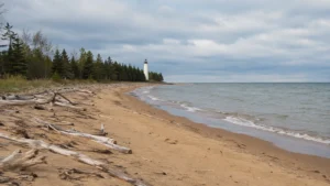
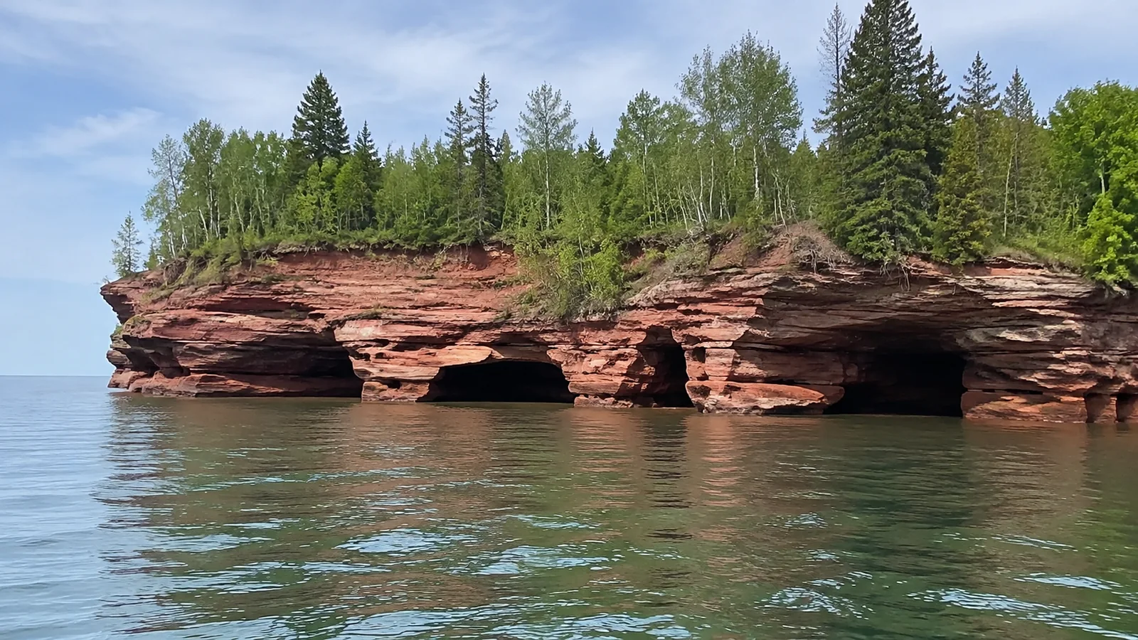
Apostle Islands National Lakeshore protects 21 islands and part of Wisconsin’s Lake Superior mainland. The islands are accessible only by water, while the mainland sea caves begin from the Meyers Beach area west of Bayfield.
Sea caves occur at the mainland cliffs, Swallow Point on Sand Island, and the north end of remote Devils Island. The same sandstone shapes appear in each place, but the exposure, crossings, rescue options, landing choices, and required experience are not remotely identical.
Bayfield is the service hub for cruises and many visitor needs, while Cornucopia and Red Cliff are closer to some west-side launches and outfitters. Madeline Island is not part of the national lakeshore, and its car ferry does not provide road access to the park’s outer islands.
Choose among four trip types
- Route class: Meyers Beach to the first mainland caves and back
- Approximate commitment: About 4 miles round trip; roughly 2 to 3 hours paddling, with 3.5 to 4 hours for a guided outing
- Exposure and retreat: Cliff sections have few landing options; return to Meyers before conditions build.
- Route class: Little Sand Bay to Sand Island and selected caves
- Approximate commitment: Roughly 3 to 4 miles each way before extra shoreline exploration; full tours commonly total 8 to 9 miles and most of a day
- Exposure and retreat: An open crossing separates you from the mainland; a safe island landing may mean waiting rather than crossing back.
- Route class: Little Sand Bay toward the outer islands and Devils Island
- Approximate commitment: Expedition scale: one documented route totals about 38 miles, with 10 miles to Otter Island, an 18-mile Devils Island circuit including a Bear Island detour, and 10 miles back; allow at least three paddling days plus weather layovers
- Exposure and retreat: Long exposed legs and limited bailout options; permit camps and route-specific skills are essential.
For context, Lost Creek’s shorter mainland tour allows 2 to 2.5 hours on the water, while its Sand Island trip expects 8 to 9 miles. These are examples of the difference in commitment, not promises that a guide can reach the caves on every departure.
I would book the guided mainland option for a first visit because you get instruction and a clear return point without an island crossing. Devils Island belongs in an expedition plan with experienced partners, not as a spontaneous extension when the morning looks calm.
The Northeast Wisconsin Paddlers trip report documents those outer-island legs and explains how a worsening forecast changed the group’s return plan. I would use that distance as an expedition example, then work with experienced partners on legal camps, conservative daily mileage, and extra weather days.
1. Guided mainland sea caves
For most first-time visitors, a guided trip from Meyers Beach is the clearest fit. Authorized outfitters offer half-day and full-day options, provide appropriate boats and safety equipment, screen participants, teach basic technique, and cancel or reroute when conditions exceed their operating limits.
The launch has a stair carry between the parking area and beach, so disclose mobility, lifting, balance, and medical needs before booking. Ask whether staff carry boats, how long participants paddle, the minimum age, the capsize plan, and what happens if waves close the caves.
Guided does not mean guaranteed. A responsible company may replace the caves with a protected route or cancel entirely, which is disappointing in the precise way good risk management sometimes is.
2. Independent mainland caves
Experienced sea kayakers can launch at Meyers Beach after checking access, parking, weather, waves, water temperature, and closures. NPS reports fatal kayaking accidents at the caves and warns that reflected wind and boat waves create confused water against the cliffs.
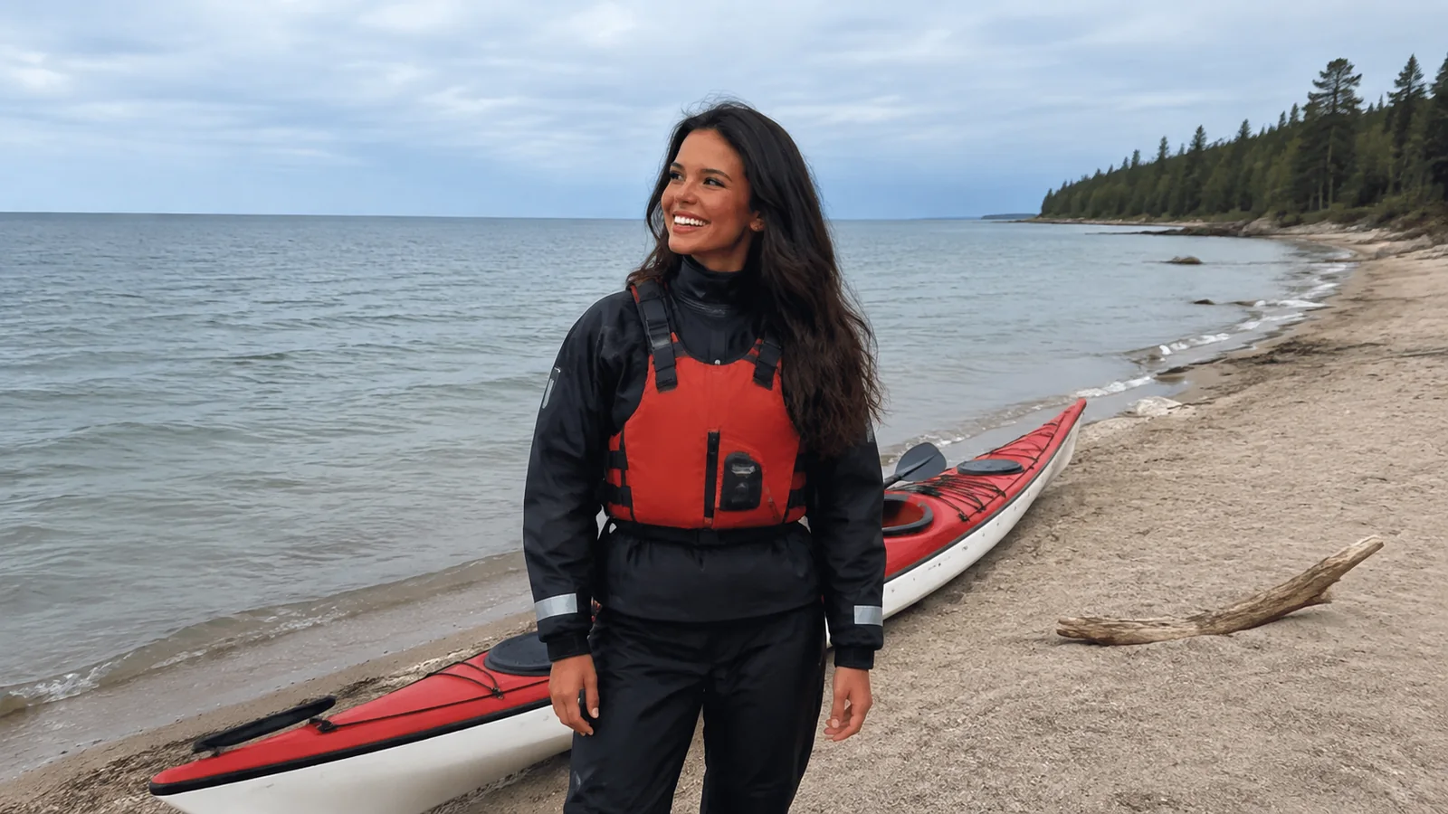
Paddlers need a proper sea kayak, immersion protection, practiced wet exits and rescues, a capable group, navigation, marine communication, and enough judgment to turn around before the caves. Being able to paddle the distance on flat water is only one small line on the résumé.
3. Sand Island day trip
Sand Island has caves at Swallow Point, a lighthouse, trails, beaches, and campsites, but reaching it involves open Lake Superior water unless an authorized water taxi provides support. Wind direction can make one side of the island manageable and another unpleasant or dangerous.
A guide or water-taxi-assisted plan can reduce route complexity but cannot eliminate rough landings or changing weather. Confirm where the taxi can land, how kayaks are carried, pickup communication, delay procedure, and whether the paddling segment fits every participant.
4. Outer islands and overnight routes
Devils Island and multi-island itineraries belong to skilled sea kayakers with open-water navigation, surf landing, loaded-boat handling, self-rescue, assisted rescue, cold-water, weather, and camping experience. Long crossings offer little shelter, and fog can remove the island you were confidently pointing at five minutes earlier.
Plan every crossing rather than preserving an “outer loop” at all costs. A permit assigns legal camps, but it does not promise that wind will let you reach them safely.
Use the right kayak
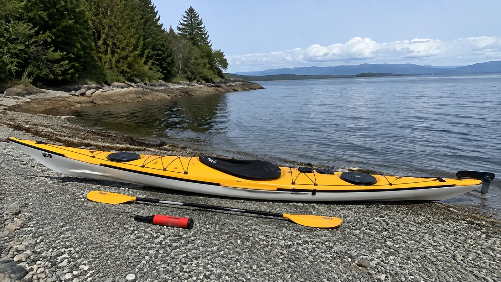
NPS specifically does not recommend small open boats, canoes, open-cockpit or sit-on-top kayaks, and paddleboards at the sea caves. Its Apostle Islands kayaking guidance emphasizes suitable equipment, rescue planning, marine forecasts, and honest skill limits.
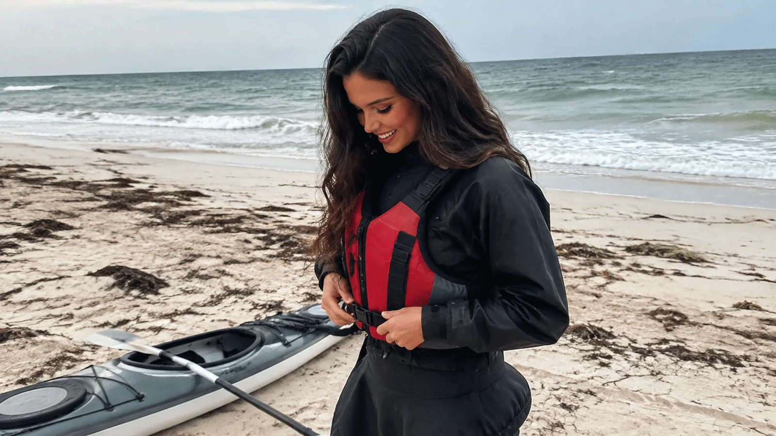
A touring sea kayak should have secure flotation through sealed bulkheads, deck lines, a properly fitted spray skirt, and capacity for the route. Each paddler needs a correctly fitted personal flotation device worn throughout, not decorating the rear deck like a very safety-conscious throw pillow.
Inflatables and short recreational kayaks may be pleasant on protected inland water, but that does not make them appropriate for exposed Lake Superior cliffs and crossings. Follow NPS and outfitter craft requirements even if a product page uses the words “ocean” or “adventure.”
Cold water changes everything
Lake Superior can be dangerously cold when the air feels warm, and a capsize can quickly reduce breathing control, strength, and useful movement. Dress for the water temperature and rescue time rather than the parking-lot forecast.
A properly fitted dry suit with insulating layers is the conservative choice for cold conditions, while any wetsuit decision must match water temperature, exposure, and rescue plan. Cotton is poor insulation when wet, and a rain jacket is not an immersion suit.
Practice wet exits, self-rescue, and assisted rescue in the actual clothing and boat setup before the trip. If no one in the group can reliably reenter a swamped boat in waves, the group does not have a rescue plan yet.
Read weather as a sequence
Check the marine forecast before traveling, again before launching, and during the route when communication allows. Wind direction, sustained speed, gusts, wave period, thunderstorms, fog, visibility, air temperature, and water temperature each affect the decision.
Use the National Weather Service Duluth marine-zone map: LSZ146 covers Port Wing to Sand Island, LSZ147 covers Sand Island to Bayfield, and LSZ150 covers outer Apostle Islands waters. Choose every zone your route crosses; the broad Lake Superior forecast supplements that local check.
Offshore wind can make the outbound shore look wonderfully smooth while increasing the effort and exposure needed to return. Onshore wind can build surf at landings, and reflected waves at cave walls may arrive from more than one direction.
Set group turnaround thresholds before launch, including thunder, visibility, wind, waves, fatigue, cold, illness, equipment trouble, and schedule. “We paid for parking” is not a weather criterion.
Essential safety and communication gear
- Touring sea kayak, spray skirt, paddle, and secured spare paddle
- Properly fitted PFD worn by every paddler
- Dry suit or suitable immersion protection with insulating layers
- Bilge pump, paddle float, tow system, and repair supplies
- Waterproof marine VHF radio and appropriate emergency beacon
- Whistle, visible signaling gear, waterproof light, and reflective material
- Charts, compass, and navigation skills independent of a phone
- First-aid kit, emergency shelter, food, and extra water
- Sun, rain, and hypothermia protection
File a float plan with someone ashore that includes boats, people, colors, route, camps, vehicle, return time, and when to call for help. Update that person if the plan changes while communication is available.
Know which VHF channels to monitor and how to make a distress call before the launch. Cell coverage is not dependable enough to serve as the group’s only communication system.
Meyers Beach access and fees
Meyers Beach Road is off Highway 13 about 5 miles east of Cornucopia and provides beach, trail, and mainland-cave access. NPS currently lists a parking fee and stairs down to the kayak launch.
The park has no general entrance fee, but charges can apply for Meyers Beach parking, camping, docking, lighthouse programs, and other services. Check the current NPS fee page instead of assuming an America the Beautiful pass covers every expanded amenity.
Little Sand Bay has another mainland kayak launch and free parking under current NPS information. The two launches serve different plans, so do not substitute one into a sea-cave route without recalculating distance, exposure, landings, and forecast.
How to choose a guide
Apostle Islands National Lakeshore does not operate guided kayak tours, but it publishes a current list of businesses authorized to guide within park boundaries. Start with the official commercial services list, then compare trip design and participant requirements.
- Which route and launch does the tour use?
- Is the trip inside national lakeshore boundaries?
- Is the company currently authorized for that activity?
- What guide certification, first aid, and rescue training does staff hold?
- Are dry suits, spray skirts, footwear, and PFDs included?
- What swimming, paddling, age, weight, mobility, and medical rules apply?
- How many guests paddle with each guide?
- What conditions trigger a reroute, cancellation, refund, or credit?
Describe prior experience accurately and ask whether a skills class should come first. A half-day guided mainland outing and a guided overnight still demand very different fitness, comfort, and recovery abilities.
Camping permits and reservations
All camping within Apostle Islands National Lakeshore requires a reservation and permit. NPS says camping is available on 18 of the park’s 21 islands and at three mainland sites, with no drive-up car or RV camping inside the lakeshore.
Individual and primitive-zone itineraries currently open within a 30-day booking window, while group sites use a different process that includes a March lottery. Review the current NPS camping page for site type, fees, group limits, amenities, landing information, and closures.
The Recreation.gov confirmation email is not the final permit. NPS instructs visitors to print the official permit from their account within the available window or arrange pickup in Bayfield.
If severe weather makes the next crossing unsafe, remain safely ashore and contact park staff as soon as possible to arrange an itinerary change. The NPS camping procedure waives change fees for severe weather and campsite closures; a reservation never justifies a dangerous crossing.
Carry extra food and fuel, discuss fallback landings before departure, and follow staff instructions about an alternate campsite. Once safe, report your location and revised plan rather than silently changing the permit.
Bears, water, and low-impact camping
Black bears can swim among the islands and may occur anywhere in the park. Store food, trash, drinks, toiletries, and other scented items in provided lockers or approved bear-resistant systems, and keep at least 50 yards from bears under current NPS guidance.
Potable water is only seasonally available at selected locations, so verify current operation and carry a treatment method. NPS advises boiling lake water for two minutes or using a filter with an adequate 0.4-micron pore size.
Do not wash with soap in the lake, disturb cultural resources, carve sandstone, or enter closed nesting areas. Pack out trash and inspect boats and gear to avoid transporting aquatic invasive species.
When is the best season?
Summer offers the broadest outfitter, water taxi, camping, and visitor-service choices, but the lake remains cold and storms still cancel trips. Late spring and fall bring colder water, fewer services, shorter daylight, and a thinner margin for delayed landings.
There is no dependable month when the caves are always calm. Reserve flexible days, choose refundable arrangements where possible, and let the forecast decide which coast or activity earns the morning.
Winter ice-cave access is a separate, rare activity and not a kayaking season extension. NPS reports the mainland ice caves were open only 2 percent of days from 2000 through 2023, and current status must be checked before any winter trip.
Alternatives when kayaking is canceled
The Lakeshore Trail from Meyers Beach provides cliff-top views near the mainland caves without entering the water, though hikers must stay back from eroding edges. An authorized cruise or water taxi may offer another perspective if its captain determines conditions are suitable.
Little Sand Bay’s visitor facilities, Bayfield, and regional scenic stops can rescue a rough-water day. The northern Wisconsin planner helps build backups that feel like plans rather than consolation prizes.
Lighthouse enthusiasts can also compare boat-access sites in the Lake Superior lighthouse guide. A lighthouse cruise and a kayak landing have separate operating limits, so verify each directly.
A realistic first-timer plan
Stay two or three nights near Bayfield or Cornucopia, reserve an authorized guided mainland-cave trip early in the visit, and preserve another morning as a weather backup. Pack warm layers and plan a trail, museum, town, or cruise alternative before seeing the forecast.
Experienced paddlers planning independent or overnight travel should use the broader Lake Superior kayaking checklist and obtain current charts, permits, and local briefings. Route ambition should shrink as uncertainty grows.
The Apostle Islands reward paddlers who treat the caves as one possible part of a safe trip rather than a promise. Match the boat, clothing, skills, permit, and forecast, then let Lake Superior decide how much sandstone theater appears that day.