
Inuvik is a Western Arctic community, a regional service centre, and a junction between air travel, the Dempster Highway, and the separate road to Tuktoyaktuk. A useful visit starts by respecting that local context and checking every seasonal transport dependency before arrival.


Understand Inuvik before planning activities
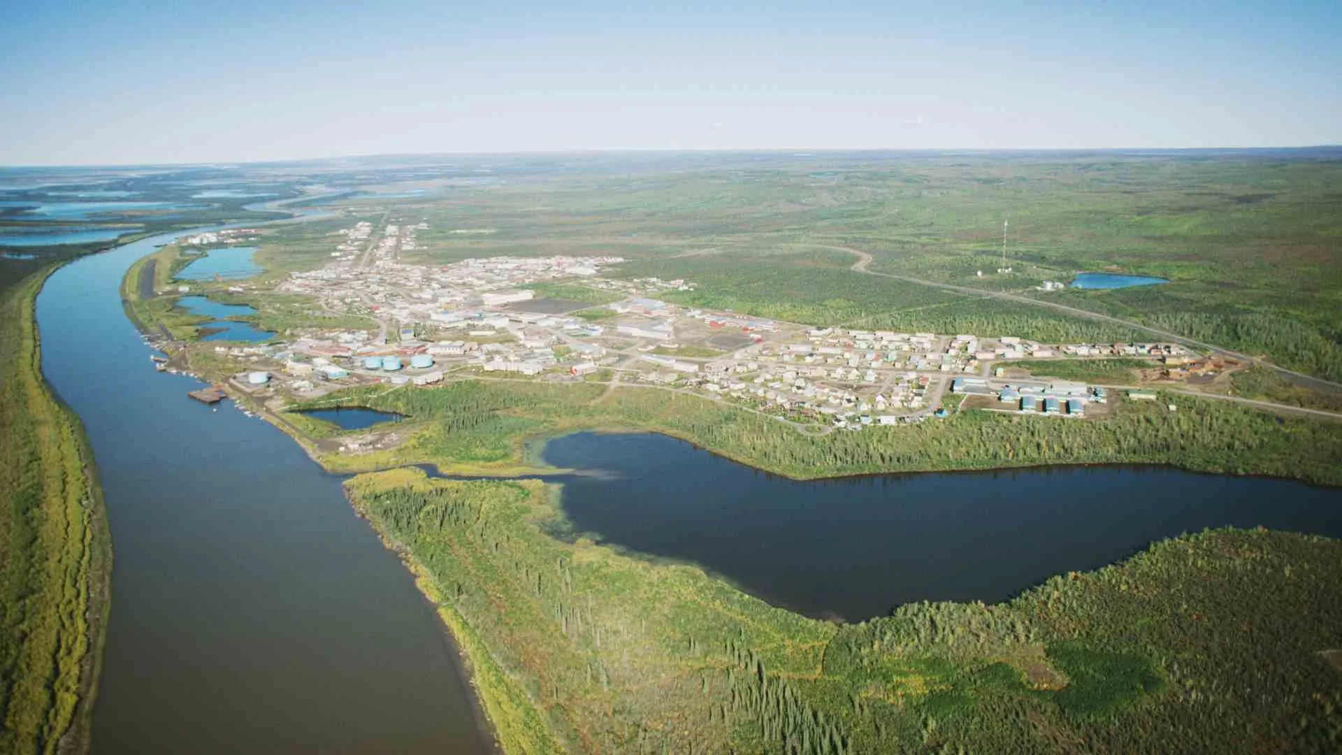
Inuvik sits on the East Channel of the Mackenzie Delta in the traditional lands of Inuvialuit and Gwich'in. Métis and other residents are also part of the community, so descriptions should preserve these distinct identities rather than compressing everyone into generic northern culture.
The Town of Inuvik's community overview provides the appropriate geographic and civic starting point. Living culture, harvesting, homes, workplaces, and community events are not automatically visitor attractions.
Inuvik also serves as a practical base for supplies, lodging, transport decisions, and locally offered experiences. Availability can change, so use current municipal information and contact individual operators instead of relying on a copied business list.
Choose the right access mode
Arriving by air
Flying separates the trip from many road and ferry dependencies, but it introduces airline schedules, baggage limits, ground transport, weather, and accommodation coordination. Confirm airport-to-lodging arrangements rather than assuming a taxi, shuttle, or rental vehicle will be waiting.
Air access can also support a community-focused visit without making the full Dempster drive. That can be a better fit for travelers who do not have a permitted vehicle, remote-road experience, or enough schedule flexibility for changing conditions.
Driving the Dempster Highway
The Dempster is an unpaved remote route with very limited services. The Town's Dempster Highway guidance explains that road access can be interrupted during Peel and Mackenzie River freeze-up and break-up transitions.
Check both Yukon and Northwest Territories road and ferry sources for the actual travel date. An open segment near Inuvik does not prove that the whole route from Dawson is passable.
The Canada road trip guide offers general pacing ideas, but the Dempster requires stronger redundancy. Fuel margins, tire plans, communications, supplies, rental permission, and the ability to wait or turn around all matter.


Keep Inuvik and Tuktoyaktuk separate
Highway 10 connects Inuvik and Tuktoyaktuk, but Tuktoyaktuk is not an Inuvik neighborhood. It is a distinct Inuvialuit community with its own local government, services, visitor expectations, land context, and access decisions.
Pingo Canadian Landmark is adjacent to Tuktoyaktuk, not located in Inuvik. It is also managed separately by Parks Canada, so a trip to Inuvik does not automatically include access to the landmark or its boardwalk.
Before adding Tuktoyaktuk, confirm Highway 10 conditions, vehicle or rental authorization, fuel, lodging, food, communications, local visitor services, and a respectful plan for the community. Do not treat an Arctic Ocean photograph as proof that swimming, sea ice, or shoreline access will be appropriate.
Build an Inuvik town day
Start with current visitor information
Ask what is genuinely open and public on the day of the visit. This is more reliable than following an old list of shops, galleries, church hours, tours, or festival events.
Use the answer to choose a small number of compatible stops. A cultural program, community event, guided outing, and independent trail each involve different permissions and logistics.
Our Lady of Victory Church
The distinctive church is widely recognized, but exterior visibility does not guarantee interior access. Check current services, visitor hours, photography expectations, and any closure before planning to enter.
If a service or private event is underway, prioritize the congregation rather than sightseeing. A respectful exterior view can be the correct choice when access is uncertain.
Arts and cultural interpretation
Look for current, publicly advertised programs led by Inuvialuit, Gwich'in, or community organizations. Purchase work through legitimate local sellers and follow photography guidance for artists, people, performances, and culturally sensitive material.
Do not call an item or interaction authentic merely because it occurs in the North. Specific makers and organizations should describe their own work and identity.

Walk Boot Lake Trail thoughtfully
The Town identifies Boot Lake Trail as a named local loop with two trailheads and potential year-round walking, running, skiing, or snowshoeing use. That description is not a guarantee of grooming, dry footing, wildlife absence, or suitability for every visitor.
Check surface, weather, construction, wildlife, snow, and daylight conditions before starting. Carry what the current conditions require and turn back when footing, visibility, fatigue, or local notices make continuation unwise.
Stay on the established route and avoid creating shortcuts through sensitive ground. Give local trail users room, control pets according to current rules, and pack out everything brought in.
For additional ways to think about weather-dependent recreation without assuming one environment transfers to another, see the site's Minnesota outdoor activities guide. Inuvik still requires local, date-specific trail guidance.
Events are date-specific, not permanent attractions
Community calendars may include arts, music, sport, seasonal, or cultural events, but dates and visitor access can change. Confirm the organizer, location, tickets, transport, photography rules, and whether the event is intended for the public.
Do not schedule a trip around an event mentioned in an undated article. Even recurring events can change format, capacity, timing, or venue.
A canceled event does not make the trip unusable if the itinerary includes flexible public spaces and rest time. The same low-cost planning principle appears in the site's free Twin Cities activities guide, though the actual activities and access conditions are entirely different.


Season, daylight, and weather
Seasonal daylight patterns are predictable in broad terms, but clouds, smoke, storms, and the traveler's schedule still determine what is experienced. Do not promise 24-hour sun, aurora, a particular color of sky, or enough darkness for photography.
Aurora visibility requires multiple conditions to align and can never be guaranteed. Treat it as a possible bonus rather than the sole justification for an expensive or tightly timed journey.
Freeze-up and break-up are processes, not fixed calendar appointments. River crossings and road access can change during transitional periods, which is why live territorial notices matter more than historical averages.
Wildlife is similarly uncertain. Observe animals from a substantial distance, never feed them, follow current local guidance, and do not approach for a photograph.
Remote-trip safety without false reassurance
No article can declare a remote trip safe for every person, vehicle, or season. Assess the actual route, weather, health needs, communications, experience, rental rules, and official notices.
Download maps and reservation details, but do not mistake offline data for current road information. Tell a trusted person the route and establish specific check-in and escalation steps.
Carry essential medication, weather-appropriate layers, food, water, and basic supplies for a delay. The exact kit depends on access mode and season, so use current local and professional advice where specialized equipment is involved.
If conditions exceed the group's ability or vehicle, change the plan. A flight, guided outing, shorter town visit, or canceled road segment can be the responsible alternative.


Two useful itinerary models
Community-focused visit
Arrive by air or confirmed road access, settle into lodging, and use current visitor information to choose public community sites. Add Boot Lake Trail only when current conditions and personal ability support it.
Leave space for a community-led program or local purchase rather than demanding cultural access. This model works without a trip to Tuktoyaktuk.
Dempster journey with an Inuvik pause
Treat Inuvik as a recovery and reassessment point after the Dempster. Inspect the vehicle, rest, replenish supplies, confirm lodging, and check Highway 10 separately before deciding whether to continue.
Do not let a prebooked Tuktoyaktuk night override new road, weather, or vehicle information. The onward journey is optional, while arriving prepared and respecting closures is not.
Final planning checklist
Accessibility and health needs
Ask exact questions about steps, surfaces, seating, washrooms, doorway widths, transportation, medication storage, and emergency support. A general accessibility label cannot describe every trail, venue, vehicle, or seasonal surface.
Travelers with time-sensitive medical needs should discuss the itinerary with an appropriate clinician and confirm local service limitations. Do not assume that regional-centre status means every test, medication, specialist, or evacuation option is immediately available.
Budget without fixed prices
Remote transport, lodging, food, vehicle permissions, baggage, and guided experiences can shape the budget more than admission fees. Request current quotes and identify which bookings are refundable if roads, ferries, weather, or flights interrupt the plan.
Set aside a contingency for an extra night or changed transport, but do not treat any amount as guaranteed to cover every disruption. Insurance terms, exclusions, receipts, and assistance procedures should be reviewed before purchase.
- Recognize Inuvik as a community in the traditional lands of Inuvialuit and Gwich'in.
- Choose air or road access based on current conditions and traveler capacity.
- Check Dempster roads and Peel and Mackenzie ferry dependencies.
- Confirm church, trail, event, tour, lodging, and transport access directly.
- Keep Tuktoyaktuk and Pingo Canadian Landmark separate from Inuvik.
- Avoid promises about daylight, aurora, wildlife, ice, road passage, or safety.


Inuvik deserves more than a quick label as a gateway. Plan for the community itself, respect distinct Inuvialuit and Gwich'in contexts, and let current transport information determine whether the Dempster or Tuktoyaktuk road belongs in the same trip.

Ellie is the founder of Ellie's Travel Tips, where she shares practical cruise tips, port guides, and step-by-step itineraries to help you plan smarter trips for less. Her checklists and packing guides turn travel daydreams into doable plans.